
Abstract:
Our project queries how digital data and computational analysis can reveal the ephemeral traces of European occupation on the North Atlantic island of Newfoundland. Between ca. 1500 and 1904, Newfoundland’s shorelines were seasonally occupied and abandoned by transient French fishing crews, who crossed the Atlantic every year to prosecute the cod fishery. Many of these sites were never occupied permanently, and now lie abandoned beneath a landscape that has been subject to a century of unintentional rewilding. However, these sites are not lost, for our project uses recent advances in digital data collection and computational developments to read the anthropogenic origins of these landscapes in novel, non-invasive ways.
Links to Online Materials: An initial summary of project results can be read here: https://www.academia.edu/34890498/LowElevation_Aerial_Survey_of_Historic_Fisheries_Sites_on_the_Island_of_Newfoundland
The French Transatlantic Cod Fishery, 1508-1904

The Fishery
Transatlantic cod fishery
French crews crossed the ocean to fish in Newfoundland’s waters for about five centuries, ending in only 1904. This was seasonally done, in the absence of land ownership- fishers occupied shoreline sites for a summer season, in which they engaged in a complex process of drying cod on beaches, until it was hard-cured. The processed cod was then loaded on board the ship in time for the autumn to return to the European market.
Cod was landed, gutted, given a light salting, and then laid either on wooden platforms, or directly on beaches the French called ‘galets’, to dry. It was a lucrative trade that shaped the island’s history for a half millennium, but left few traces behind, as these were temporary occupations.
With a multi-disciplinary approach involving archival research, archaeological survey and the application of remote sensing technologies, these landscapes can be rendered legible.

Some work of fish drying took place directly on cobblestone beaches. This served to create soil, and enrich it with phosphorus, nitrogen, and calcium. Over five hundred years, not only was the landscape changed in subtle ways, but also the chemical composition of the soil itself was altered. Library and Archives Canada, Ref. No. PA-202293
The indicated stand of plants rise abruptly from the surrounding meadow in a geometrical pattern. Closer inspection revealed that this square marked the debris pile from a collapsed 20th century house. Growing out of this debris pile was a stand of Fallopia japonica, or Japanese knotweed. This is an invasive species that thrives in disturbed areas and once established, can spread rapidly.
By mimicking the shape of the collapsed house, it reminds us that plants can reflect anthropogenic origins. This collapsed house was subsequently identified in a mid 20th century aerial photo to the right, which corresponds perfectly with the shape of knotweed growth in this location. Image copyright A. Crompton and M. Bolli, 2011.

Temporary structures- wooden fish drying platforms that would have collapsed every year, and stage structures built out of wood and roofed with ship’s sails, which would have been abandoned every year and taken the brunt of sea ice and wave action. Library and Archives Canada, Ref. No. PA-202290

These were ephemeral occupations because they were transient and seasonal. Nevertheless, the same places were used repeatedly, as the documentary record indicates. A good beach to dry fish 500 years ago was a good place 50 years ago. Five centuries of building small, impermanent shoreside structures, as seen in this mid 19th century photo had an impact on the shape of the contemporary landscape. Library and Archives Canada, Mikan no. 3574464
Anthropogenic clues
These are now abandoned landscapes. Many former French fishing stations were abandoned after 1904 and never reoccupied. Yet a record of their presence there is contained, not just in historic maps and surveys, but also in the soils that were formed, and in the contemporary vegetation that grows overtop of these sites (both in species composition and patterning). These plants now feed on soil enriched by the incidental incorporation of discarded fish bodies and offal. Cartographic evidence tells us a little bit about what a French fishing station would have looked like, but it is inexact and abstract in detail. So in effect we are using the contemporary landscape as a source of information about the location and layout of fishing stations.
Similar anthropogenic landscapes can be seen in the image to the left and below.

The mid 20th century aerial image clearly shows the rectangular structure coinciding neatly with the knotweed growth in the image to the left. Image credit: Government of Newfoundland and Labrador.
Crop Marks in Agricultural Field Systems: an Analogous example
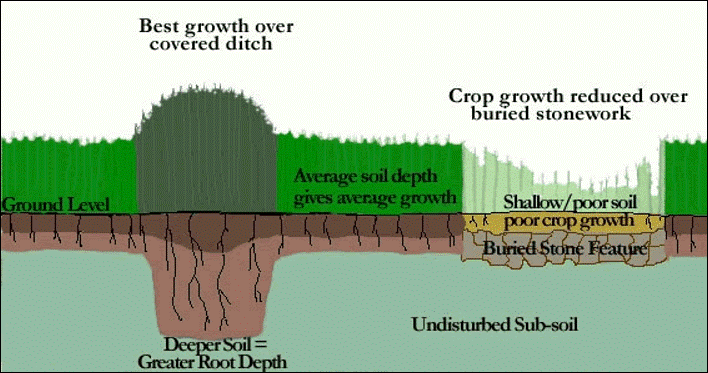
Image credit: Creative Commons

Image credit: Creative Commons
The practice of looking for archaeological remains as reflected in contemporary floristics is well developed in agricultural regions, typically using aerial remote sensing techniques. In the images above, crops that grow overtop of archaeological features display varied patterns of growth and discoloration (crop marks), which reflect differences in soil quality. These patterns can be readily observed in farmers’ fields, where single crops are grown. We argue that analogous patterns can be observed in the heterogeneous plant landscapes of the north Atlantic island of Newfoundland, which occur in the absence of large scale agriculture.
A related but different challenge
Our challenge lies in documenting this in wild environments. We seek plant species that favour growing in disturbed soils, or soils that are strongly associated with soil enrichment and anthropogenic change. We also search vegetation that grow in atypical patterns, which hint at an anthropogenic origin. In effect this foliage serves as a biological artefact of anthropogenic activity.

Our current investigations are concentrated on the Island of Newfoundland (the island highlighted in blue).

Newfoundland’s Northern Peninsula is a location rich in former historic french fishing sites. But Cremaillere harbour among, other sites in the indicated rectangle above, stands out as an ideal research location. Many sites were abandoned by the French and rarely re-occupied. This region provides the ideal field laboratory to test our methodologies.
Vegetation Shadows and Enriched Soils
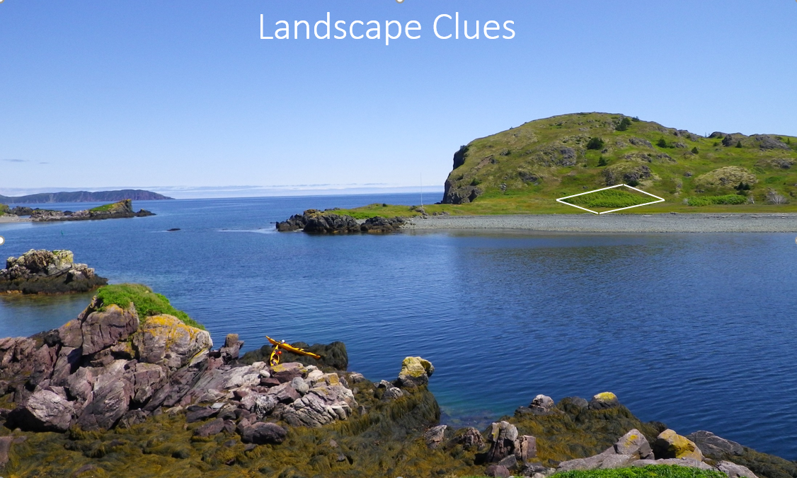
What we are looking for is abnormal patterning in contemporary vegetation that feeds off discrete areas of former human activity. Here you can see one in Cremaillere harbour, where a square depression from a structure of some sort has been marked by a stand of Angelica atropurpurea- purplestem angelica, and the similar broad leaved Heracleum maximum, or cow parsnip, both of which prefer wet soils and hence often grow in anthropogenic depressions, usually in suspicious rectangular forms. We have also noted the tendency for wild raspberry plants to favour growing out of cobblestone galets, preferring well drained soils. Using geochemical techniques such as ICPMS soil analysis can demonstrate soil enrichment that correlates with the observed anthropogenic anomalies.

An anomalous patch of vegetation which indicates an archaeological feature. Image copyright: A. Crompton & M. Bolli, 2018.

Remnants of a cobblestone galet used for drying fish, now completely overgrown. Image copyright: A. Crompton & M. Bolli, 2018.
This shoreline was a very busy place. The existing archival recordscan give us a general sense of what fishing stations looked like but we do not have detailed layouts for individual places. Our research is designed to fill in the gaps in our knowledge of how French fishermen lived on these shores.
Mapping Landscapes

The location of a former French fishing site on the Northern Peninsula. Image copyright: A. Crompton & M. Bolli, 2018.
Example: Cremaillere harbour
To document the anthropogenic shadows that we see growing as biological artifacts, we use both ground-based, manual vegetation surveys and low elevation aerial remote sensing. Using affordable, Unmanned Aerial Vehicles (UAVs) allows us to capture a birds’ eye view of the archaeological site, perform vegetation classification, topographical analysis and search for anthropogenic patterns in the landscape. Low altitude aerial imagery gives us the needed resolution and detail to identify individual plant species and characterize vegetation patterns that are the signatures of underlying archaeological features.
Some sites can extend over a substantial geographic area. Simple aerial images such as the one displayed on the right, are able to provide limited, additional interpretative information. With the application of remote sensing methods, we are able to render aerial imagery tiles into a mosaic of data points, which allow us to apply analytical techniques. These accurately describe the topography, vegetation characteristics and anomalous landscape patterns. Such orthographically accurate computational models of archaeological sites provide us with predictive models indicating loci of historic activity.
From Image tiles to orthomosaic models
Using photogrammetric algorithms, we transform many nadir aerial image tiles into data points, from which we are able to generate analytically useful orthographic models. These allow us to measure features, classify vegetation patterns and visualize anomalous terrain characteristics.

Aerial panorama view of an archaeological site in Cremaillere harbour. Image copyright: A. Crompton & M. Bolli, 2018.

Partial view of a cartographically correct orthomosaic model derived from hundreds of aerial imagery tiles, rendered into data points using photogrammetric software. Image copyright: A. Crompton & M. Bolli, 2018.

A DJI MAvic UAV with multispectral sensor attached, in flight. Image copyright: A. Crompton & M. Bolli, 2018.
UNMANNED Aerial Vehicles as remote sensing platforms
UAVs provide an ideal and inexpensive vehicle with which to gather large numbers of image tiles for a given geographical area. We image sites in both the visible light and other spectra such as in the near infra-red (NIR). This multi-spectral approach allows us to distinguish variable vegetation patterns with a high degree of precision. The differential reflectance values of various plant species in particular multispectral bands allows us to make inferences about underlying soil conditions, which in turn, tells us about historic site formation processes.